
“You do not travel if you are afraid of the unknown, you travel for the unknown, that reveals you with yourself.” – Ella Maillart
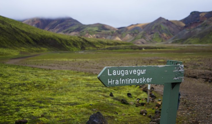
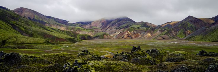
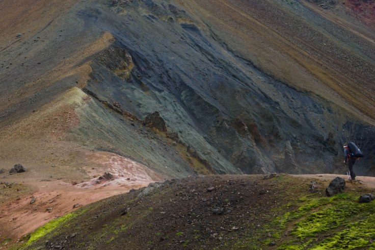
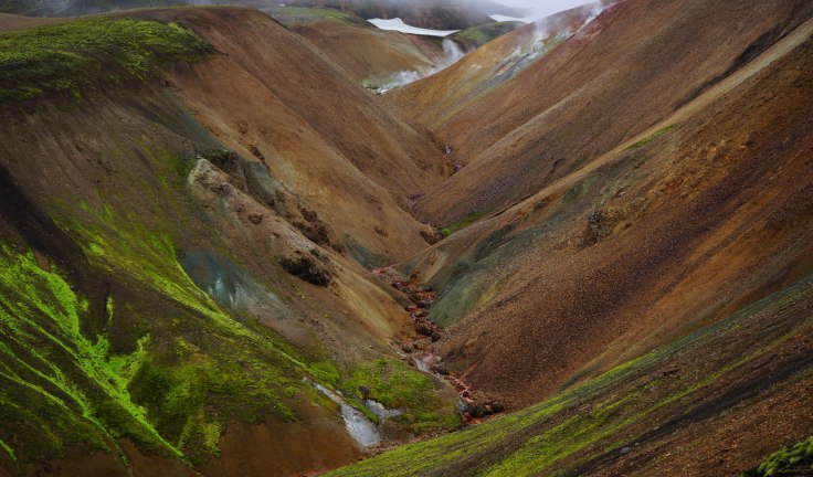
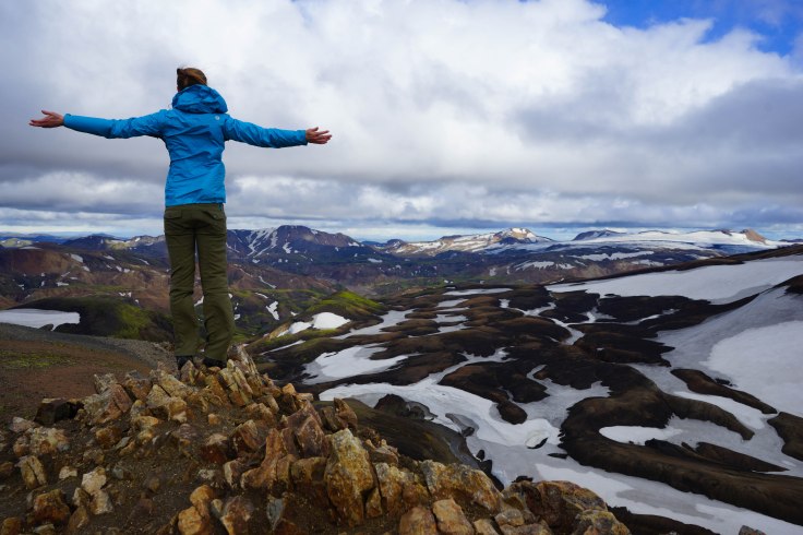
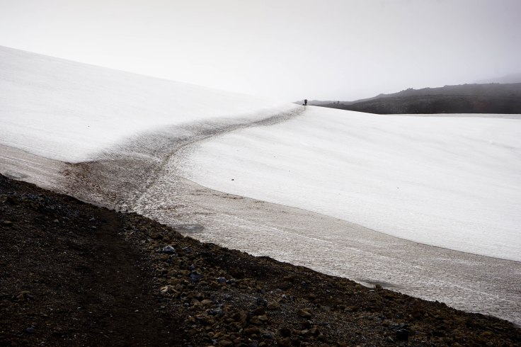
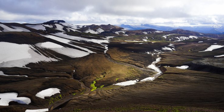
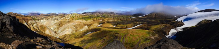
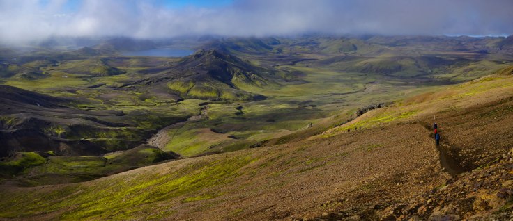
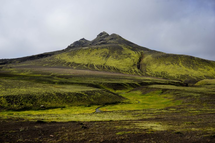
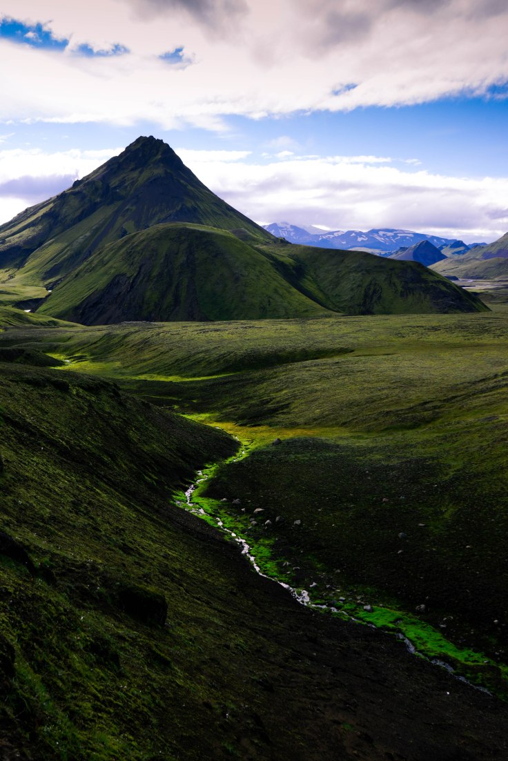
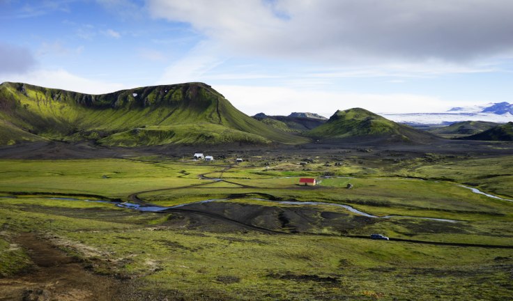
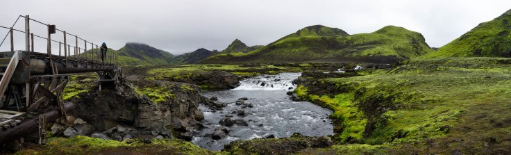
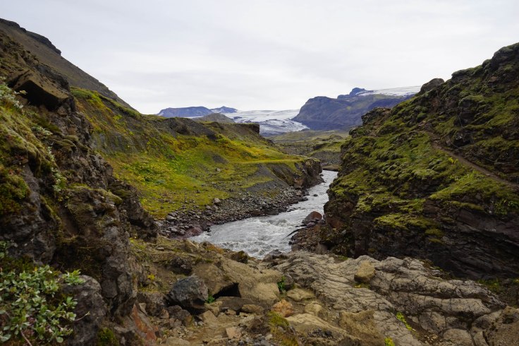
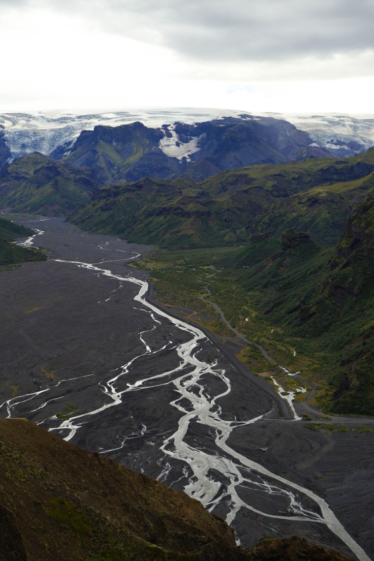
The geothermal wonderland of Iceland boasts some incredible hiking opportunities through the most surreal landscape. The Laugavegur Trail (also called the Laugavegurinn Trail) is one of the most beautiful treks I have ever done. It was so stunning it made me swear quietly under my breath on multiple occasions. The 55km trail stretches north-south from Landmannalaugar to Þórsmörk (pronounced Thorsmork) weaving between mountains and glaciers and volcanoes and lakes and ice caves and valleys and the list goes on! The trail is fairly easy to follow, but it does have some short steep and slippery climbs and freezing cold river crossings. Even though it was at times very cold, windy, raining and snowing it was an absolutely incredible experience.
This is a fairly long post, but I hope you can hang in there until the end 😉 If you have any questions just contact me via the contact form at the bottom of the page!
The trail is open to hikers usually from mid June to mid September, however if there is residual snow on the access roads after winter the trail may not open until mid July, and it could also close early for the same reason. The trail is called the Laugavegur after one of the main shopping streets in Reykjavik. It is given this name because of the popularity of the trail during the peak of the hiking season. However, I hiked during the last week of the season and despite it being at the colder end of the season (in the negatives during the night – celcius that is), the trail wasn’t very busy.
Depending on the amount of time you have, your fitness level and hiking experience this 55km trail can be done over 2-4 days. It can be walked in either direction, but if you walk from north to south you have a slight total decrease in altitude compared with the other direction (winning!). I walked it in three days which still gave me enough time to do a few of the side walks.
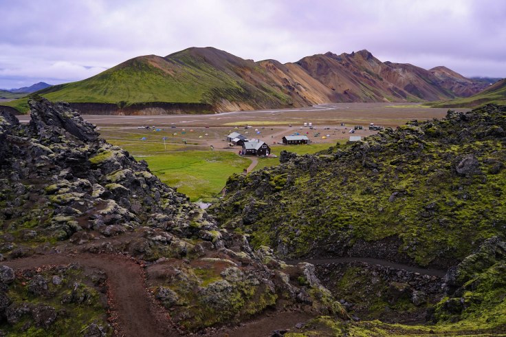
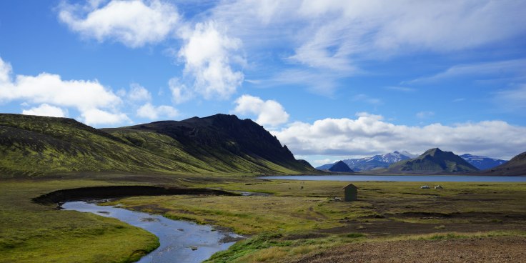
Landmannalaugar → 11km → Hrafntinnusker → 11km → Álftavatn → 5km → Hvanngil →11km → Emstrur → 15km → Þórsmörk
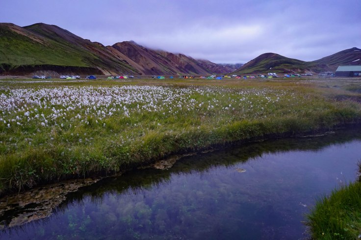
(At each of these locations is a hut and a campsite)
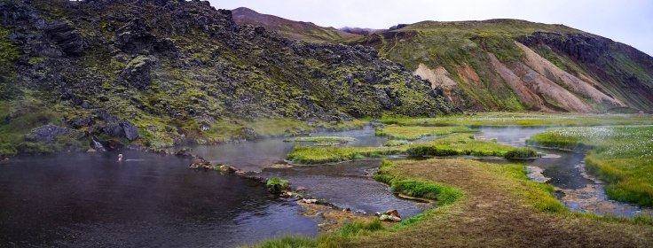
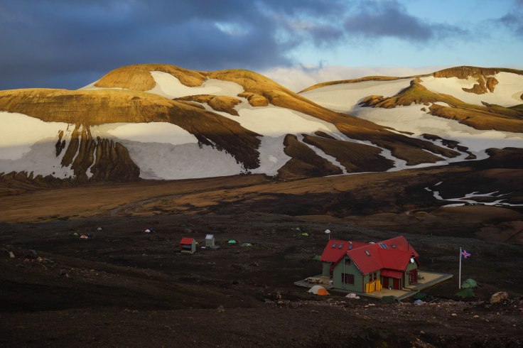
I wasn’t quite sure what to expect from the start and finish of the trail. Are they small villages? Does anyone live there? The bus driver actually laughed at me when I asked him these questions. As it turns out Landmannalaugar is basically just ‘base camp’ for the Laugavegur Trail during the hiking season. It has a hut (bookings required), camping area (no booking required), cooking area and bathrooms located in the valley floor. There is a great hot spring to swim in, and if you get up really early you will have it all to yourself! There are a heap of hot springs along the trail but they are unfortunately all too hot to swim in!
At the other end of the trail at Þórsmörk in the Húsadalur Valley, there are a few hut options, with the main one being the Volcano Huts. They have slightly more upmarket accommodation options, with a proper restaurant, sauna, massage services, yoga lessons etc. There is also a campsite (no bookings required) with access to a cooking area, sauna(!) and showers (!!).
I did this hike solo, and with some solid initial planning it went off without a hitch. People often ask me what it is like to do on my own. It can get a little lonely at times, but there is something very grounding and rewarding about doing something like this on your own. Safety tip: As a solo hiker I always make sure I am never the last one to leave camp.
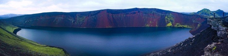
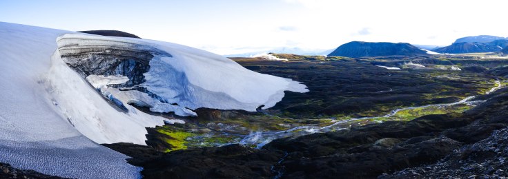
I caught an afternoon bus from Reykjavik and arrived in Landmannalaugar the evening before I started the hike (the bus trip was estimated to take 3.5 hours but did take a little longer). After a morning dip in the hot spring I packed up my gear and hit the trail. I had trouble putting my camera away because everything was so beautiful, and with each turn in the trail revealing more rainbow streaked mountains and steam gushing from the ground. My first night was at Hrafntinnusker. I arrived with plenty of time to do a couple of side walks, to the summit of Södull and to the ice cave (note: don’t go to the ice cave alone, you have to cross a fairly steep section of slippery snow and ice and a fall here would not be fun. Bring or borrow a hiking pole). That night I was lucky to experience the aurora borealis (northern lights) for the first time, which is one of the most amazing things I have ever experienced and put the cherry on the top of an already incredible hike!
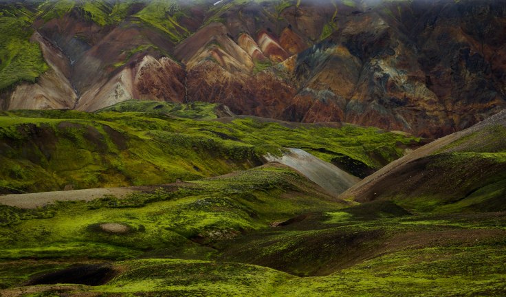
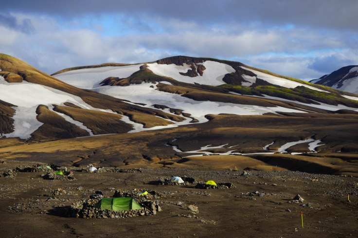
The following days went over more mountains, across snow fields, and through volcanic valleys. I camped at Emstrur and then walked out to Þórsmörk. I felt as though I was walking through a painting of a different planet. It is only the final couple of kilometers of the trail that goes through a small forest. The rest is open, rugged and sparse, but still incredibly beautiful. There are a couple of river crossings and the depth of the water will vary within the season. As it comes straight off the glacier it is freeeezing cold and I couldn’t feel my legs after the first two steps!! But when I was coming up to the 25km mark for the day it was very soothing on my feet!
I arrived in Þórsmörk in the evening. As you get to Þórsmörk there are two hut/camping areas in the valley; Langidalur and Húsadalur. They are only a little over a kilometer apart, but keep in mind that all buses leave from the Húsadalur area. As my bus back to Reykjavik (~4hrs) was not leaving until the following afternoon, I did a couple of smaller hikes around the area the next morning. Gosh was it nice to not have to carry my pack on those day hikes!
I highly recommend this trek to anyone visiting Iceland. It requires a bit more effort, but you get to be intimately engaged with the landscape and see so much more than the regular tourist visitor to Iceland.
Fees:
You do not have to pay any ‘entry fees’ to walk the trail, however you do have to pay for the huts or camping sites. The huts have to be booked far in advance to secure a spot but the camping fee (~1200ISK per night – some had eftpos facilities but best to make sure you also have cash on you) can be paid to the hut warden as you arrive at each camping ground. There is no camping allowed outside the allocated camping areas. The campsites are simple with nothing more than flat ground, but there are toilets and running water available. The huts cannot be used by the campers. At some of the campsites rock shelters have been built to shelter from some of the wind.
I camped the whole time which meant I had to carry all my own camping and cooking equipment, so I carried a total weight of about 20kg. All the huts are quite expensive but they do come equipped with cooking utensils, gas stoves and mattresses, so this means you don’t have to carry as much gear (but you still need your own sleeping bag) and on a cold and windy night you will be much warmer than I was in a tent!!
All of these huts can be booked through the Ferðafélag Íslands (FI) huts website.
- Landmannalaugar
- Hrafntinnusker
- Álftavatn
- Hvanngil
- Emstrur
- Þórsmörk (Langidalur)
Þórsmörk also has two other hut options, the comfortable Volcano Huts and the simpler Basar Hut.
Getting there:
Unless you want to walk the whole trail twice it is much easier to take public transport to and from the trail. You can leave a car at one end but it would be a real pain to get back to the other end. To drive into the Þórsmörk end you would also have to have a 4wd and feel confident with river crossings.
Reykjavik Excursions and Trex are two of the main companies running bus services to and from Landmannalaugar (~9000ISK from Reykjavik) and Þórsmörk (The Húsadalur area only ~8400ISK to Reykjavik) or check out their ‘hiking pass’ for a reduced fare. They run to Reykjavik but also make several other stops on the way if you want to stay and explore other areas. Towards the start and end of the season they run fewer buses per day so make sure to check the schedule closely so that it fits in with your predicted hiking times on the trail. I advise that you book your bus in advance as they can get full. The roads to and from the trail can get rough so be prepared for a bumpy ride!
I was only in Iceland for a week, but if you have extra time you shold consider one of these add-ons to the hike:
- Stay an extra day in Landmannalaugar – there are many day hikes in this area, and it gives you more time to enjoy a swim in the hot spring.
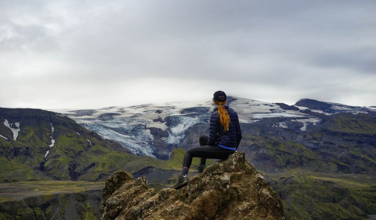
- Stay an extra day in Þórsmörk – there are also plenty of day hikes in this area, including to the top of Valahnukur for a view over Eyjafjallajökull (the ice cap covering the volcano that erupted in 2010, whose smoke cloud closed down most of Europe)
- Add the trek from Þórsmörk to Skógar (The Fimmvörðuháls Trail)- this adds approximately another 25km to the trek. It is doable in one day, however there are camping and hut options along the way if you want to break it down into two days. You can catch a bus from Skógar back to Reykjavik or to other parts of SW Iceland. Skógar is where you can see the famous Skogafoss waterfall.
Additonal Information:
- Buy a trail map from the information centre in Reykjavik.
- Be prepared for all weather conditions. It can be cold, wet and windy.
- Always carry a first aid kit.
- You must carry all your rubbish out! Take care of our beautiful mother earth!
- Know what to do in the event of bad weather. Most of the trail is easy to follow, but visibility can become challenging in heavy rain, snow or fog.
- Food:
- Besides the very small store at Landmannalaugar and the restaurant at Þórsmörk, there is no food to be purchased along the trail. I usually bring some perishable food for the first 24 hours (bread, salami, cheese, boiled eggs, fruit etc) and then I switch to simple lightweight food such as pasta, noodles and oats. Tinned tuna is also a good addition and chocolate is always a must for me. Nuts and dried fruit make for good snacks. I always bring at least one extra day of food incase there are any issues on the trail.
- I flew to Iceland from Sweden and I organised and packed most of my food there before I headed over. Firstly this meant less rushing around when I arrived in Reykjavik, and secondly, everything in Iceland is expensive, including supermarket food!!
- Carry at least 2L of water. You can fill up at all the huts.
- www.yr.no is a great website to check the weather. You can even check the weather at some of the huts along the trail! How cool is that!
- The Icelandic language is hard! It is a true Nordic language, and even with my Swedish background I found many words hard to pronouce. For example, Landmannalaugar is pronounced Landmannaleuuur (say the ending as if you have a mouthful of porridge) 😉


Note: this information is correct as of September 2016. I would advise that you check the transport and accommodation/camping information so that you do not have any issues along the way. When I did the hike I did not have to book any camping spots, but it is worth double checking this at it could very well change in the future!

2 Pingback